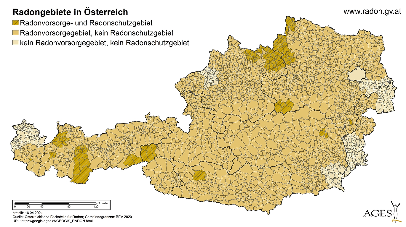
Radon map
Radon protection areas and radon precautionary areas have been defined on the basis of Austria-wide radon measurements in buildings. This enables efficient and sustainable health protection against radon. With the help of the interactive radon map, which is based on around 50,000 measurements, it is easy to determine the area in which a municipality is located.
Indoor radon concentrations depend mainly on the condition of the building and the nature of the subsoil. In some areas of Austria, high radon concentrations in buildings must be expected with increased probability due to the nature of the subsoil. In terms of health protection, it therefore makes sense to identify such areas and to take appropriate measures there.
Radon protection areas and radon precautionary areas
The new Radon Protection Ordinance contains a list of those municipalities that are considered radon protection areas. In radon protection areas, measures for the health protection of employees are mandatory. These measures are defined in the new Radiation Protection Act 2020 and are described in more detail in the associated Radon Protection Ordinance. In addition, the Radon Protection Ordinance identifies those municipalities that will be considered radon precautionary areas in the future. In radon precautionary areas, preventive radon protection measures must be provided for all new buildings, depending on the respective state regulations.
Here you can find a list of municipalities that are designated as radon protection areas or radon precautionary areas as well as the interactive radon map.
Second Austrian National Radon Project - ÖNRAP 2
In order to take health protection into account accordingly and to define the radon protection areas and radon precautionary areas, a large-scale, Austria-wide measurement campaign on indoor radon was carried out. In addition to the measurement of radon concentrations, structural data on the building were collected by means of a questionnaire. In contrast to the previous project ÖNRAP 1, the measurements in this campaign were geographically based by systematic selection. Within the framework of this new measurement campaign, approximately 50,000 measurements were carried out throughout Austria. Based on the measurement results and data collected in this way, radon protection areas and radon precautionary areas were determined using scientific methods.
Detailed descriptions of the radon situation in Austria and the preparation of the radon map can be found in the expert report on the project.
The expert report and an abridged version can also be found under Downloads.
First Austrian National Radon Project (ÖNRAP 1)
Already between 1991 and 2002, more than 20,000 radon measurements were carried out in Austrian households in the course of the first Austrian national radon project (ÖNRAP 1). The selection of households was representative of the population by random selection.
